Puerto Vallarta in Details. General Information About Puerto Vallarta, tourism, culture and economics.
Puerto Vallarta is a city and one of the 125 municipalities in the state of Jalisco, Mexico. The municipality is located in the North Coast Region of the state. It borders the state of Nayarit to the north, the municipalities of Cabo Corrientes and Talpa de Allende to the south, San Sebastián and Mascota to the east, and the Pacific Ocean to the west.
You will find more the 800 pages of information, news, activities, in this web site about all the regions surrounding Puerto Vallarta and Riviera Nayarit

It is the second most important economic zone in the state of Jalisco. It is one of the most visited places in the country.
The name Puerto Vallarta honors Lic. Ignacio Luis Vallarta, a Jalisco jurist and former governor of the state.
Location and Geographic Boundaries of the Port.
The municipality of Puerto Vallarta is located in the western part of the state, at coordinates 20°40′N 105°16′W / 20.667, -105.267, at an altitude of 2 meters above sea level. It borders the state of Nayarit to the north, the municipalities of Cabo Corriente and Talpa de Allende to the south, San Sebastián and Mascota to the east, and the Pacific Ocean to the west.
Its land area is 1,300.67 square kilometers.
It’s Port (Deep-Dwelling Port)
It is considered a deep-water port and is the second most important economic zone in the state of Jalisco and the third most important port in Mexico, as it recently began export activities.
Maritime Regions
Puerto Vallarta is located in the maritime region known as the North Pacific.
CLIMATE.
Puerto Vallarta has a semi-warm sub-humid climate with summer rains; precipitation averages 930 mm.
Warm sub-humid climates (Aw) are found in coastal areas below 700 m in altitude, with a dry season in winter and summer rains. The least humid subtype (Aw0) is found in the coastal areas and in the Banderas Valley, while the most humid subtype (Aw2) is located throughout the lower mountain region.
Puerto Vallarta Weather When is the Best Time? https://promovisionpv.com/puerto-vallarta-weather-when…/ #PuertoVallarta

GEOGRAPHICAL FEATURES NEAR THE PORT.
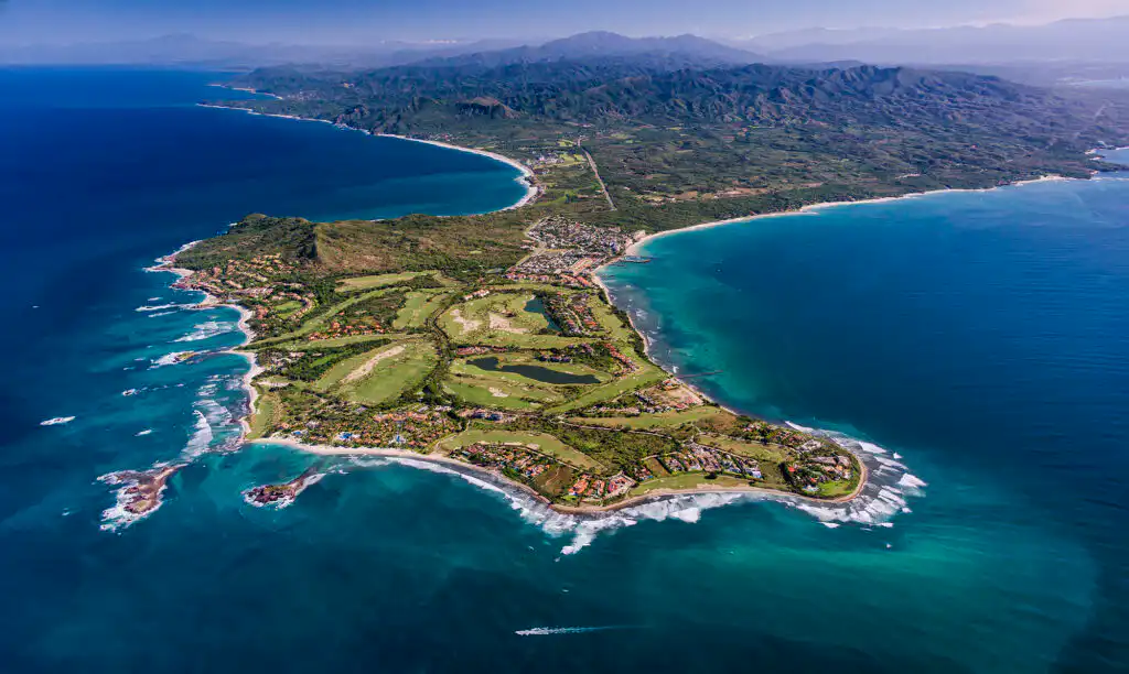
Banderas Bay is a natural bay located on the Pacific coast between the states of Jalisco and Nayarit, and gives its name to the municipality of Bahía de Banderas. It is bordered to the north by Punta Mita and to the south by Cabo Corrientes (Mexico) and is one of the deepest bays in the world (over 900 m). Despite what many people say, it is not the largest bay in Mexico. It is part of the area known as the Riviera Nayarit, and its main tourist destination, Puerto Vallarta, is located on its Riviera, in addition to others such as Jarretaderas, Flamingos, Bucerías, La Cruz de Huanacaxtle, and Punta Mita.
Cabo Corrientes is a cape in Mexico located on the Pacific coast, belonging to the state of Jalisco.
It marks the southernmost point of Banderas Bay, where the port and resort city of Puerto Vallarta are located. The municipality where the cape is located is also known as Cabo Corrientes. Cabo Corrientes is an important navigational landmark, appearing on the first maps of the region.
Islands.
Belonging to the state of Nayarit, the Marietas Islands, or Tres Marietas Islands, are a group of small, uninhabited islands a few miles west of the coast of Punta de Mita, Nayarit, Mexico. They are very popular tourist destinations because marine life abounds due to the islands being protected from fishing and hunting by the Mexican government.
Isla Isabel is an island in the Pacific Ocean, belonging to the municipality of Santiago Ixcuintla, Nayarit. It’s geographic position is: 21°52’30” N and 105°54’54” W. The island is of volcanic origin, with a maximum altitude of 140 meters above sea level, and is located 70 km from San Blas, Nayarit. It has an area of 1.94 km². There is a temporary presence of researchers, fishermen, and tourists. There is a settlement called Campamento Isla Isabel.
Punta Mita (20°45′ N, 105°33′ W). It is a low, narrow, projecting point surrounded by rocks and reefs that extends westward for a distance of 926 m. Beyond these hazards, the depths increase rapidly to 27 m.
Punta Chimo (20°29.5′ N, 105°35′ W). It is a rocky peninsula located 7 nautical miles northeast of Cabo Corrientes.
Just east of the point is a rocky reef; a short distance west of the point is a white rock 13 meters high. It was reported that 0.38 nautical miles from the point, on a bearing of 297°, there is a rock almost at the surface, marked by breakers at low tide (see chart SM-400).
Punta Piedra Blanca (20°44’N, 105°25’W) (chart SM-400) is located 2.7 nautical miles east of Punta Pedrero and is topped by a hill 106.2 meters high. A small cove at the point offers excellent anchorage with good protection from northwest winds. Punta Tabo – Punta Tabo is located 450.2 nautical miles southwest of Punta Chimo and marks the northeastern boundary of the small, open Tabo Bay, which is too deep to provide anchorage. The river of the same name flows into the bay.
Punta Isatan – Located 3 nautical miles south of Cabo Corriente, it is a grayish rocky point with sandy beaches on either side. It appears to be the most prominent point when sighted approaching from any direction and can be mistaken for Cabo Corrientes.
Punta Impala – When sighted from ships sailing near Cabo Corrientes, Punta Impala appears as a moderately high, grayish rocky headland, rounded at the front. Near its western side, some rocks protrude from the water.
Western Mountain System.
The state is located within the Western Mountain System, which is divided into four regions: the Sierra Madre Occidental to the north, the Central Plateau to the northeast (part of the Trans-Mexican Volcanic Belt, the largest region in the state), and the Sierra Madre del Sur to the south.
Los Arcos (Lat. 20° 32’ 42” N and Long. 105° 19’ W). In the vicinity of Mismaloya Beach are three notable rocks known as “Los Arcos,” 9, 8, and 7 meters high respectively. Although they do not produce a good radar echo due to their proximity to the coast, they can be interpreted as a point on radar. With good visibility, they are distinguishable at more than 5 nautical miles. On a true bearing from the port breakwaters, the following distance is observed: MV: 200° at a distance of 7 nautical miles.
Shoals. Estero Tomates: A shoal, over which the sea breaks, is located outside the entrance to the estuary. Beyond this shoal, the depths increase rapidly, with a depth of 178.4 meters (rocky bottom) found 0.75 nautical miles from the mouth of the estuary.
Rio Ameca: (Lat. 20°40’05”N, long. 105°16’15”W) Located approximately 2 nautical miles north of the Puerto Vallarta breakwaters, at the mouth of the Ameca River, it extends 0.5 nautical miles from the shore.
Beach Type.
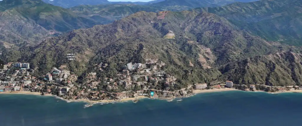
Located within Banderas Bay, Puerto Vallarta has become one of the most important tourist destinations in the country, boasting a wide variety of beaches in its surroundings, including: Playa de los Muertos, Olas Altas, Conchas Chinas, Las Amapas, Bucerias, Malecón, Boca de Tomates, Playa de Oro, Yelapa, Quimixto, Las Animas, among others. None of these beaches present any notable landmarks or navigational aids.
Playa de Nuevo Vallarta.
Beach in the Puerto Vallarta Hotel Zone.
Bucerías.
San Francisco/San Pancho Beaches.
Sayulita Beaches
Anclote Beach.
At Anclote Beach
Boca de Tomates Beach.
Marina Vallarta Beach.
Los Muertos Beach.
Garza Blanca Beach.
Gemelas Beaches.
Mismaloya Beach.
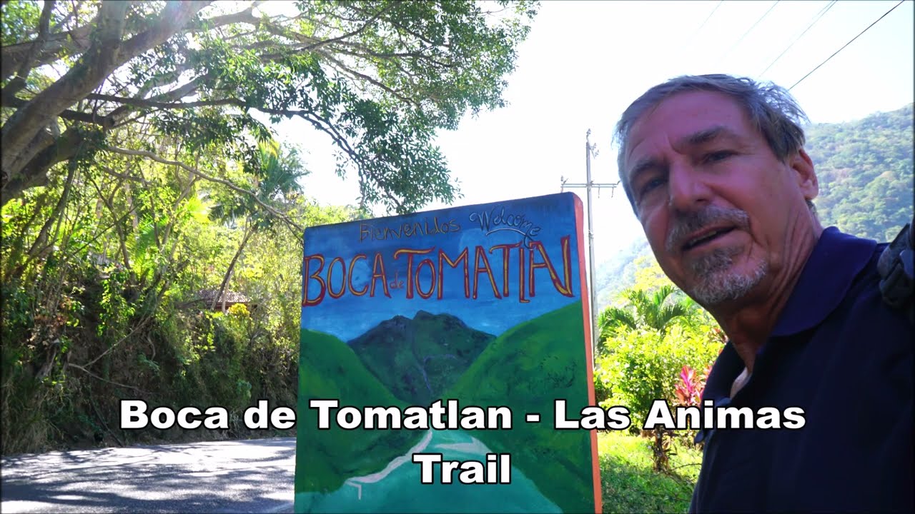
Boca de Tomatlán Beach.
Majahuitas.
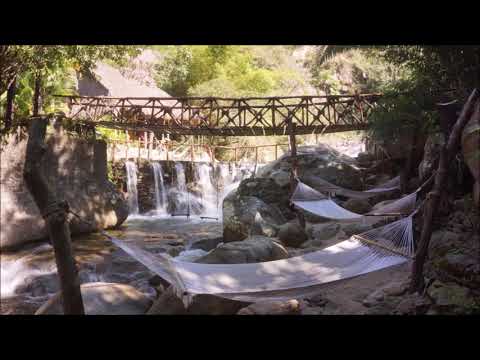
La Animas.
Quimixto.
Yelapa.
Myto.
You will find many videos of these beaches on our YouTube Channel: https://www.youtube.com/@promovision/videos
Buildings visible to navigators.
It is easy to confuse the entrance to the Port, since there is only the necessary maritime signage, as it is considered a purely tourist port with little deep-sea maritime traffic. To avoid confusion, use the airport lighthouse as a reference point, as well as the takeoff and landing areas, since the airport is located approximately 1 km north of the breakwaters.
The considerable hotel infrastructure of the “Nuevo Vallarta” resort complex and other hotels visible from the sea along the coast of Bandera Bay and near the port entrance also causes confusion for navigators. Therefore, the following observation made from the sea 5 nautical miles off the east coast of the bay should be noted: To the left, a series of hotels, the largest belonging to the modern infrastructure of Nuevo Vallarta, Nayarit, located at Lat. 20°42’N; Long. 105°19.5’W, can be seen. This infrastructure causes the most confusion because it has maritime navigation beacons for access to the marina located within it.
Ameca River.
Length of navigation channel: Not navigable.
Depth: 0.5 to 2 meters at the mouth.
High obstacles: Ameca Bridge.
Currents: Flowing from East to West.
Pitillal River.
Navigation channel length: Not navigable.
Depth: 0.5 to 2 meters.
High obstacles: Pitillal Bridge.
Currents: Flowing from East to West.
Marking beacons: None.
Cuale River.
Navigation channel length: Not navigable.
Depth: 0.5 to 2 meters at the mouth.
High obstacles: Cuale River Bridge.
Currents: Flowing from East to West.
Tomatlán Mouth.
Navigation channel length: Navigable for small fishing vessels. Depth: 0.5 to 2 meters at the mouth.
High obstacles: None.
Currents: Flowing from the south to the east.
Currents.
The two main currents are the California Current (cold), which flows down from the north, and the Costa Rica Current (warm), which later becomes the North Equatorial Current. At certain times of the year, the current flowing down from the Sea of Cortez must also be considered. This region is located at the end of the Transition Zone that separates the subtropical from the equatorial province in the North Pacific Ocean. Therefore, the climate is sensitive to seasonal variations and global processes such as El Niño and La Niña. Throughout the year, there are notable variations in the current pattern.
Climate
The climate of this region is analyzed using values provided by the main weather stations in the area. These belong to the warm, humid climate type and are located on the western part of the Jalisco coast. The highest temperatures are recorded between June and September, fluctuating between 20 and 30 degrees Celsius. The coldest period occurs in February, with temperatures between 19 and 23 degrees Celsius. These climates are subdivided into three subtypes. The most humid subtype is located primarily to the west and along the coast, including the municipality of Puerto Vallarta. Maximum temperatures fluctuate between 29 and 30 degrees Celsius. In May, June, and the coldest months of January and February, temperatures range from 19 to 24 degrees Celsius. The least humid of the warm climates is located primarily in the coastal zone of this jurisdiction and includes the municipalities of Tomatlán, La Huerta, and Cihuatlán.
The highest temperatures occur in June, July, and August, ranging between 28 and 29 degrees Celsius, and the lowest in February, with temperatures between 19 and 24 degrees Celsius. The intermediate climate, between the two, has an average annual temperature above 22 degrees Celsius and is characterized by vegetation such as lowland rainforest, medium-height rainforest, grasslands, and pine and oak forests. It is found in its highest elevations, such as the municipality of Cabo Corrientes.
Prevailing Winds.
The prevailing winds blow from the southwest and do not produce frost.
Waves.
The waves reach their greatest intensity during full moons and lunar phases.
Rainfall.
The climate is semi-warm and sub-humid, with some areas experiencing dry conditions, abundant rainfall throughout the summer, and variations between the plains and the mountains.
The annual rainfall gradient is wide, with total precipitation ranging from less than 800 mm to 1,000 mm along the coast, between 1,000 and 1,500 mm annually in the lower and intermediate elevations, and between 1,500 and 2,000 mm in the mountains. The wettest season occurs from May to September, accounting for more than 90% of the total annual rainfall. The most significant weather events in the region are storms. Tropical cyclones occur between June and October, and from November to February, the region is affected by cold vortices and jet streams.
Protected natural areas.
Vicinity of Los Arcos and Estero del Salado.
Los Arcos. Estero del Salado.
Anchorage areas.
Puerto Vallarta, Jalisco.
North Anchorage Lat: 20° 30’ 18” N Long: 105° 16’ 15” W, with an anchorage area of approximately 0.5 square nautical miles.
South Anchorage Lat: 20° 38’ 42” N Long: 105° 14’ 48” W, with an anchorage area of approximately 0.25 square nautical miles.
Fishing Zones.
Fishing for shrimp, grouper, red snapper, lobster, oysters, snook, and Spanish mackerel is permitted.
Sport fishing for sailfish and marlin is allowed in the vicinity of the port, but is restricted in protected areas such as the Salado Estuary and Los Arcos.
Maritime Traffic Direction.
All vessels offering local tourist excursions have an established route for their trips. One of the most common itineraries is as follows: Puerto Vallarta, Mismaloya Beach, Rocas de los Arcos, Playa de las Animas, Yelepa, Quimixto, and back to Puerto Vallarta. These routes are regulated and supervised by the Port Authority.
Navigation Channels.
The 250-meter-long navigation channel, with a minimum depth of 12.4 meters, is marked by buoys, four on the east side. Numbered odd numbers from 1 to 7, with a range of 3 nautical miles (MW) for both geographic and luminous range, cylindrical iron beacons painted green with a light height of 2.5 m, and two on the port side, numbered 2 and 4, with a range of 3 nautical miles (MW) for both geographic and luminous range, cylindrical iron beacons painted red with a light height of 2.5 m.
Seabed Type.
The seabed is sandy and rocky, except at the mouths of the Ameca, Pitillal, and [other rivers].
Puerto Vallarta has a total of 463 meters of docks designated for the following uses:
Cruise Ship Dock.
As a primarily tourist port, Puerto Vallarta has three cruise ship docks under the jurisdiction of the Port Authority, with the following dimensions: Dock 1: 202 m long, 12 m wide, and 3 m high above sea level. Dock 2: 200 m long, 12 m wide, and 3 m high above sea level. Dock 3: 200 m long, 12 m wide, and 3 m high above sea level.
Marina Vallarta, S.A. de C.V. is a private company with the infrastructure of a tourist marina in the inner harbor, which includes facilities to provide services to yachts, sailboats, and smaller vessels.
This port does not have mooring buoys established by the port authority; however, there are some on the shallow beaches owned by recreational boat service providers, and these are for vessels no longer than 40 feet.
Groynes.
Puerto Vallarta has five groynes to minimize the impact of waves on the beaches with hotel services.
Airport.
The Puerto Vallarta International Airport is located 7.5 kilometers from the city of Puerto Vallarta, Jalisco, and 10 kilometers from the destination of Nuevo Vallarta in the state of Nayarit, in Banderas Bay.
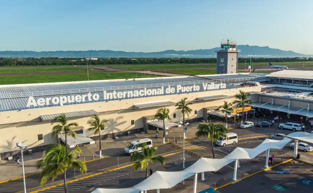
It has two terminal buildings: the main commercial aviation terminal and the general aviation terminal, in addition to a Fixed Base Operator (FBO) operated by Aerotron Corporate Air Services.
It has a 3,100-meter-long by 45-meter-wide runway, designated 04-22, and several taxiways connecting to the commercial and general aviation platforms. The runway allows for unrestricted service to the routes and aircraft currently operated by the various airlines.
Radar assistance.
The Puerto Vallarta Regional Port Authority operates continuously, 24 hours a day, 365 days a year. It is staffed by personnel from the Port Authority with experience in the operation of maritime navigation and communication equipment, as well as in the maritime and port sector.
There is a Mexican postal service office in the municipality of Puerto Vallarta for sending mail.
PREDOMINANT VEGETATION.
The flora is very diverse; there are chilte trees, hardwoods such as tampicirán and brazilwood, and woods such as amapa, primavera, parota, cedar, and walnut, suitable for furniture making. Palm trees and other fruit trees such as mango, soursop, and avocado proliferate along the coastal strip. One of the species that has suffered the most from urban growth is the oil palm, which grows in a very restricted area and should be protected.
ECONOMIC ACTIVITIES.
1- Tourism.
Tourism is one of the main drivers of economic development in this municipality.
Puerto Vallarta offers its residents and visitors a good number of beaches that are visited daily. Here, one can admire a great many natural beauties, historical monuments, and works of art, which attract many national and international tourists. Tourism is widely promoted in Puerto Vallarta, as the municipality also has nudist beaches, ecological areas, and mountains with beautiful landscapes, making it highly attractive for this economic activity.
2- Agriculture.
Various agricultural activities are carried out in the areas surrounding the municipality of Puerto Vallarta, including the cultivation of corn, beans, and sorghum.
3- Livestock.
Livestock farming stands out among the most widespread rural activities in the state of Jalisco, with approximately 9,000 head of cattle raised annually.
4- Fishing.
Puerto Vallarta has significant fishing potential, both freshwater and marine. It boasts 260 kilometers of coastline and an exclusive fishing zone of 87,884 square kilometers, encompassing territorial waters and the continental shelf. Additionally, it has a system of estuarine lagoons covering 76,240 square kilometers and 110,000 hectares of inland waters. However, the importance of this economic activity at the national level has been minimal.
5- Mining.
Several quarries operate in the municipality of Vallarta, extracting stone for construction and copper.
6- Oil.
Puerto Vallarta does not have oil reserves within its territorial or maritime boundaries.
7- Industry.
The industry in the municipality of Puerto Vallarta focuses on tourism service providers in terms of logistics, spare parts, fuel, lubricants, and everything else related to tourism services.
8- National and International Trade.
The trade in Puerto Vallarta is geared toward tourism and everything that service providers need to offer good service.
LOCAL AUTHORITIES.
1- Municipal Government.
Puerto Vallarta is the municipal seat, and its mayor.
2- Military.
The 41st Military Zone of the Army is located in Puerto Vallarta.
3- Naval.
The Eighth Naval Zone of the Mexican Navy and the Puerto Vallarta Hospital are located in Puerto Vallarta.
4- State Police.
The State Police (Secretaría de Seguridad y Protección Ciudadana) is located in Puerto Vallarta at Col. Las Juntas 153, Puerto Vallarta. The phone number is (322) 290-0658.
5- Federal Preventive Police.
The Federal Preventive Police station is located in Puerto Vallarta at Km. 7.5 on the Tepic-Puerto Vallarta Highway, Col. Villa las Flores, near the airport. International Airport Gustavo Díaz Ordaz (322) 221-1527 and 221-1065
6- Port Captaincy.
The Port Captaincy of Puerto Vallarta, under the jurisdiction of the Ministry of Communications and Transportation, is located in the inner harbor at Blvd. Francisco Medina Ascencio Km 4.6, Puerto Vallarta, Jalisco.
7- Comprehensive Port Administration.
The Comprehensive Port Administration of Puerto Vallarta promotes the economic development of the region by fostering the consolidation of a competitive, multipurpose port that offers port infrastructure and services, with a team committed to meeting the needs of users and protecting the environment.
8- Maritime Customs.
There are several maritime customs offices in the port that provide services to cruise ships and other recreational vessels.
9- Immigration.
The National Migration Institute Delegation in Puerto Vallarta is an entity that provides efficient, honest, and secure immigration services in accordance with international standards. It is located inside the cruise ship pier customs area.
TOURIST SITES.
1- Tourism Office
The Puerto Vallarta Tourism Secretariat has an office that provides guidance to tourists on visiting the main recreational centers, as well as hotels, road guides, airport information, and tourist assistance and emergency phone numbers. It is located at Independencia Street 123, Colonia Centro, telephone 226-8080. Another option is to call toll-free 01 (800) 903-9200, which is the Tourist Assistance number.
2- Historical Monuments
Temple of Our Lady of Guadalupe: Built in 1918. The facade is exposed brick. The four-tiered central tower was constructed in the 1950s, and in 1965 a concrete crown supported by eight angels of the same material was added.
In 1987, the side turrets were built, and the facade was also completed.
Inside, the vaults are supported by columns with fluted shafts and Ionic capitals adorned with garlands. These vaults house works of art such as the Stations of the Cross, modeled in plaster, the communion rail, the pulpit and confessionals carved from wood, the marble altar, and the image of Our Lady of Guadalupe, painted by the renowned artist from Jalisco, Ignacio Ramírez. The original crown fell during the earthquake of October 9, 1995, so the current one is made of fiberglass.
Saucedo Theater: This building, reminiscent of the Belle Époque, is located at the corner of Juárez and Iturbide streets. It was built for Juan Saucedo and the Italian engineer Angel Corsi in 1922. The ground floor hosted various shows, ranging from theater, musicals, and boxing matches to films. The second floor housed a casino where the young people of the port gathered, and elegant receptions were frequently held there. During the Cristero War, the army converted the theater into a barracks and stables. It is currently a fabric store.
Municipal Hall: Construction began in September 1980, and the building was designed by architect Francisco López Ruvalcaba. It was inaugurated by President José López Portillo and officially handed over to Mayor Rafael González Pimienta in September 1982. The project was funded and managed by the State Department of Public Works of the Puerto Vallarta City Council. Inside, you can admire the mural designed by Manuel Lepe, which depicts the founding and development of the port. The Malecón, the most important historical monument for the people of Vallarta, consists of a boardwalk approximately one kilometer long along the beach, from Aquiles Serdán Park (Los Arcos) to the Hotel Rosita. Since 1936, it has been a favorite spot for residents and visitors to stroll and admire the sunsets.
The Lighthouses: Old port navigation lights built in 1932. One is located in front of the Caballito monument and the other on the hill along Matamoros Street.
Previously, when the El Salado port was built, they were painted white so that ships wouldn’t mistake them for navigational aids. On June 24, 1978, the mayor ordered that they be preserved as a historical and sentimental monument in the life of Puerto Vallarta.
Ixtapa Ceremonial Center: This site consists of 29 mounds scattered over an area of approximately 10 hectares. One of the larger mounds, partially destroyed, has a diameter of 40 meters and a height of 7 to 8 meters. It is believed that a ball court was played here and that it was built by tribes of the Aztatlán culture, which settled in the valley around 900 AD. and 1200 AD. Some of the objects recovered from the area are on display at the Museum of the Cuale River Island.
Monument to the Boy Heroes:
A white marble obelisk located at the end of the marina boardwalk.
It was unveiled in 1991 by the Association of the Heroic Naval Military School at its Annual Assembly held in this city.
This monument is dedicated to the memory of the boy heroes who gave their lives in the battles of Chapultepec and Veracruz.
Sculpture of Ignacio L. Vallarta: A bronze sculpture by the artist Miguel Miramontes;
it is located in front of the municipal building.
It was donated by Governor Juan Gil Preciado in 1964.
Miguel Hidalgo y Costilla: A bronze sculpture by the artist J. Esteban Ramírez Guareño. It was inaugurated in 1988 in Hidalgo Park, replacing a smaller one made of cement by the same artist and installed in 1954.
Sculpture of Lázaro Cárdenas: a bronze figure placed in the park of the same name, is the work of a group of students from the University of Michoacán.
Benito Juárez: A bronze sculpture by Miguel Miramontes, located on the Paseo de la Marina.
Fountain of Friendship or The Dolphins: a bronze sculpture by James (Bud) Bottoms, donated to Puerto Vallarta by the residents of Santa Barbara, California, in 1987; it is a replica of the one in that city.
Neptune and Nereid: A bronze group by the artist C. Espino. It is located on the Malecón in front of the municipal building. It represents Neptune, the Roman god of the sea, son of Saturn, brother of Jupiter and Pluto, and husband of Amphitrite, one of the fifty Nereids. It was inaugurated in 1990.
Nostalgia: A bronze and granite sculpture by Ramis Barquet. It is located on the north side of the boardwalk and depicts a couple in love “gazing dreamily toward the sea, toward the mountains, toward the small town, toward life with intense joy…” It was installed in 1985.
John Huston: A bronze sculpture by the artist Carlos Ramírez. It is located on the east side of Isla del Río Cuale and represents the famous film director who, in 1963, filmed “The Night of the Iguana” in Vallarta, a film that brought so much publicity to the port. The Fisherman: a bronze figure by sculptor Ramis Barquet, reminiscent of one of the typical characters of old Vallarta, the fishmonger. It is located at the end of the bridge over the Cuale River, across from the municipal market.
The Little Horse: a bronze sculpture by the artist Rafael Zamarripa,
originally placed on the rock formation called
Las Pilitas, at the end of Los Muertos Beach, but the waves
and winds toppled the structure, which remained
lost for several years. In 1976, the same sculptor created
another one, which was placed on the boardwalk in front of the old lighthouse.
The Whale and Calf: installed in 2000 near Marina Vallarta, it is a tribute to these
enormous travelers; according to Vallarta residents, it is the largest bronze sculpture in the world.
3- Cultural Buildings.
One of Vallarta’s attractions that opened its doors in the spring of 2010 is the Vallarta Theater.
With its 912 seats, it invites you to enjoy the best events, making it a prominent
cultural center on the Mexican Pacific coast. Since its opening, the theater has hosted a wide variety of national and international performances, including the Russian State Ballet, the renowned Vagina Monologues, and Fandango. The theater is home to an exceptional modern art gallery showcasing unparalleled works by great visual artists, with a strong emphasis on Mexican talent.
4- Archaeological Zones.
According to surface research, the pre-Hispanic site of Ixtapa covered approximately 60 hectares, extending from the northern edge of the present-day town, roughly from Guerrero Street, to the old channel of the Mascota River on the north bank. The western edge was marked approximately by the modern road from Ixtapa to El Guayabo, and the eastern edge reached the Santo Domingo stream.
Within the site area, we recorded 29 structures, primarily mounds constructed of earth and river stones, varying in size and state of preservation. There are collections of artifacts from the surface of some of the mounds, as well as from cultivated fields and looting sites or other places where the soil deposit had been exposed by excavation work. Each collection area, apart from the structures, is indicated on the map we made of the site with the help of surveyors provided by the municipality of Puerto Vallarta.
5- Ecological Parks.
In terms of ecology, Puerto Vallarta has much to offer: nature reserves, hiking, sea turtle releases, and flora and fauna observation. One of the most important attractions of this destination is its splendid natural environment, as the bay’s geographical location provides a privileged habitat for a great variety of wildlife that lives in the estuaries.
Los Arcos: Located 1 km from Paredón Colorado, opposite Mismaloya, it is an underwater park that offers a fascinating landscape of three arches carved by marine erosion over thousands of years. This protected natural area offers a fascinating landscape formed by three arches on the islets of the area. For an observation walk, you will find the lush vegetation of the Sierra Madre in this area: pines, oaks, firs, oyamel firs, and junipers.
Boca de Tomates: Located 10 km northwest of Puerto Vallarta, at the mouth of the
Ameca River. The turtle camp here allows you to participate in ecological preservation activities in Puerto Vallarta. Children and adults can help release
sea turtles. The recovered eggs are placed in hatcheries or incubation “corrals,”
where they remain protected and safe.
Boca de Tomatlán: Located 16 km southwest of downtown Puerto Vallarta, it is the most accessible beach if you are traveling by road; the palapas there offer seafood dishes, snacks, and drinks. In this small village, you can take hiking tours to observe endemic flora and fauna.
Marietas Islands: Located 41 km north of Banderas Bay, this group of islands has been declared a Biosphere Reserve. Here you will discover amazing caves, canyons, and cliffs. Here you will find magnificent species considered endangered.
Banderas Bay: Banderas Bay is a vast paradise for all kinds of water sports. The most popular are water skiing, windsurfing, deep-sea fishing, scuba diving, snorkeling, yacht excursions, kayaking, parasailing, and banana boat rides. South of the Cuale River: The main area of downtown is divided by the Cuale River, which features a small island that has become home to a museum and several shops, bars, and restaurants.
Las Caletas: Among the tourist attractions of Puerto Vallarta is Las Caletas. This secluded spot on the southern coast of Banderas Bay is accessible only by sea, as the terrain rises abruptly from the shore and the jungle is lush.
Colomitos: Located southwest of Puerto Vallarta and south of Boca de Tomatlán, this area offers opportunities for hiking and observing birds, butterflies, lizards, and tropical trees.
The Zoo: Eclectic yet always lively rhythms fill the air at this zoo. Techno, reggae, and rock will have you dancing until you unleash your inner Tarzan or Jane.
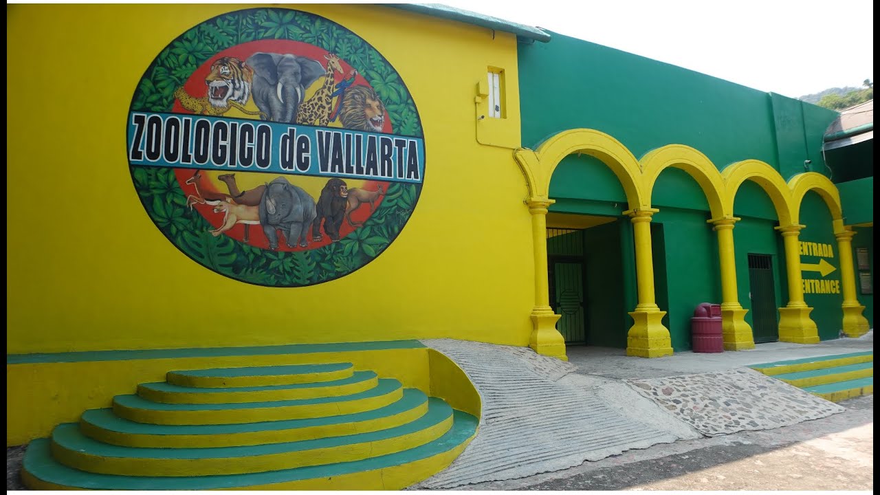
Puerto Vallarta Zoo in the jungle of the Sierra Madre. https://promovisionpv.com/puerto-vallarta-zoo-in-the-jungle-of-the-sierra-madre/
6- Recreation Areas
Puerto Vallarta is one of the main tourist destinations on the Mexican Pacific coast, and even in the entire Mexican Republic, where travelers will find wonderful places to relax. Some of these sites are mentioned : Tours to Yelapa, Las Ánimas, Quimixto, and Majahuas: Relax and sunbathe in Yelapa, Quimixto, Las Ánimas, and Majahuitas, places from which you can see the northern coast of Banderas Bay.
Whale, Dolphin, and Sea Lion Watching: There are seasons when it is possible to take boat trips, especially around the Marietas Islands, to see dolphins, whales, manta rays, or sea turtles. Snorkeling and diving into the water, swimming alongside multicolored fish, is also highly recommended. After the water activities, you can enjoy the fun of the different beaches nearby.
Eden: Located in Mismaloya, you’ll venture into the jungle along the trail that runs parallel to the Mismaloya River, right above the El Edén restaurant. It was in these locations that the movie “Predator,” starring Arnold Schwarzenegger, was filmed in 1986.
San Sebastián del Oeste: You can take an excursion to San Sebastián, ideal for those seeking contact with history, culture, ecology, and tranquility. This small town, founded by the Spanish in the Sierra Madre Occidental, features white houses with red roofs, gardens, and cobblestone streets, all surrounded by pine, ash, cedar, and coffee trees, making it the perfect place for a relaxed encounter with nature and culture.
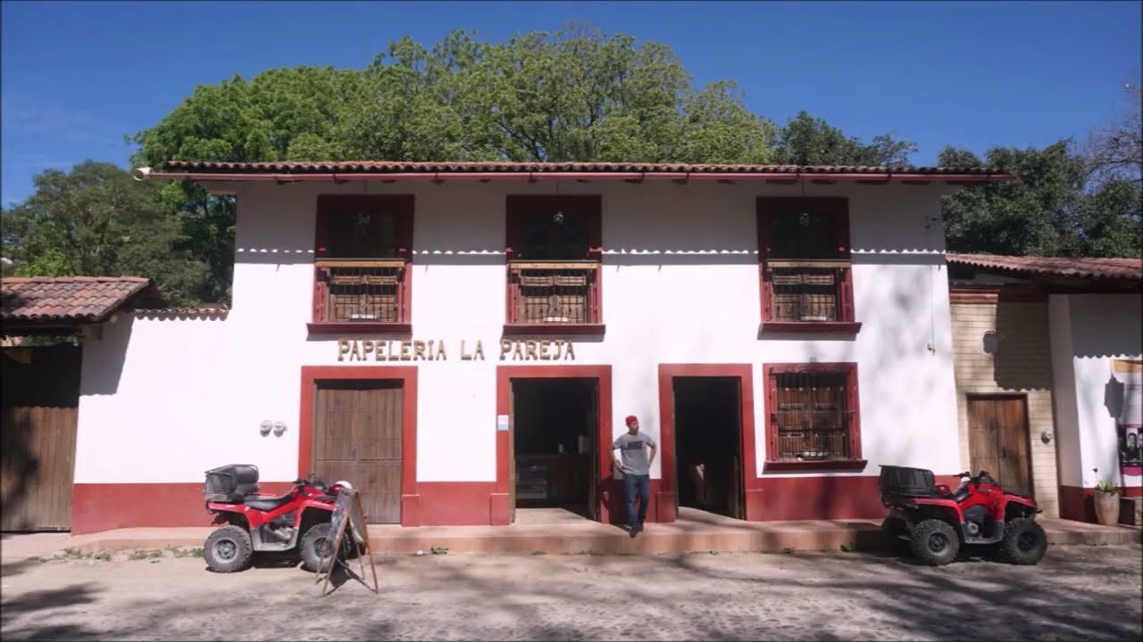
San Sebastian del Oeste Jalisco https://promovisionpv.com/san-sebastian-del-oeste-jalisco/
Tequila Distilleries: The so-called “Tequila Tour” consists of an explanation of the tequila-making process at the “Don Crispín 100% Pure Blue Agave: The First and Only Artisanal Tequila Made in Vallarta” distillery; it includes a tasting of tequila in its different presentations: blanco, reposado, and añejo, as well as raicilla and tequila flavored with mandarin, almond, and coffee.
7- Lodging.
The beautiful city of Puerto Vallarta is located in the state of Jalisco, Mexico. Currently, this city is one of the most visited in Mexico, thanks to its wide variety of tourist attractions.
Puerto Vallarta is known for its warmth, friendly service, diverse entertainment options, art, and culture. In fact, this city is considered the friendliest in the world, according to Condé Nast magazine.
In Puerto Vallarta, there are options for everyone, from luxurious and exclusive 4, 5, and 6-star hotels to budget-friendly hotels, which are also very pleasant and offer all the amenities for a comfortable stay.
8- Transportation
Local bus routes in Puerto Vallarta serve the main tourist centers of the resort, providing an efficient and economical way to explore every corner of this destination.
Find your way around and Discover Puerto Vallarta and Riviera Nayarit. https://promovisionpv.com/how-you-can-go-around-and-discover-puerto-vallarta-and-riviera-nayarit/
The buses run from 6:00 AM to 11:00 PM. When traveling on these buses, don’t be surprised if a spontaneous “artist” decides to liven up the trip with a varied musical repertoire, which includes songs about lost love and lack of money. At the end of the “show,” the performer will go around the seats asking for a voluntary donation from the passengers.
To find your way around on the bus, keep in mind that buses marked with the sign “Centro” (Downtown) go to the heart of Vallarta and Olas Altas; those identified as “El Túnel” (The Tunnel) take the detour to Olas Altas; and those going to the airport are marked “Ixtapa,” “Las Juntas,” or “Las Palmas.”
There are also buses that go to the Marina, Pitillal, Mismaloya, Nuevo Vallarta, and Punta de Mita. Buses going to the southern zone (Mismaloya or Boca de Tomatlán) depart from the corner of Constitución and Basilio de Badillo streets.
On the other hand, Puerto Vallarta has a good number of taxis, whose zonal fares are set by the government. Inquire at the hotel reception about the amount of these fares, or ask the driver about the cost of the service before getting in the vehicle.
9- Market.
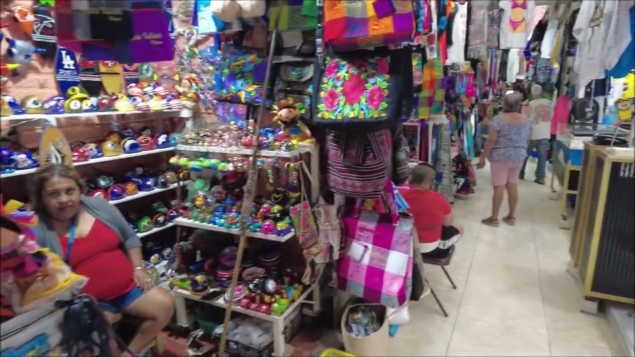
Because Vallarta is not an agricultural region, there are very few farmers willing and able to sell their products in any kind of market. Almost all produce is sold from the back of traveling trucks and local fruit stands. A tianguis is a remnant of the traditional Mexican weekly market. The word “tianguis” comes from the Nahuatl word “tianquiztli,” which means day market or harvest market. Vallarta Central Market: Every city needs a good tourist trap, a place to buy a wide variety of trinkets with the city’s name printed on them…. Well, this is the place. Prices depend on your bargaining skills. It’s a large, two-story building packed to the brim with every imaginable type of Mexican tourist merchandise. The real advantage of this market is that there’s an upstairs food court with some very authentic, inexpensive restaurants, mostly serving comida corrida, traditional Mexican food. Adjacent to but separate from this market is the Isla Cuale Market of similar or identical goods, located on the neighboring river island.
The Emiliano Zapata Market: Very much a neighborhood market with butcher shops, small production stands, and a small assortment of locksmiths, houseware stores, and a florist. Around the back are several small restaurants hidden from street view that serve locals with good, hearty, very inexpensive meals. December 5 Market: This market is a neighborhood far from the usual tourist routes. It has a good collection of fish markets and several nice produce markets. There are the usual household goods stores, also with some small restaurants inside.
Shopping for Grocery Shopping in Puerto Vallarta https://promovisionpv.com/shopping-for-grocery-shopping-in-puerto-vallarta/ places and locations
The Aramara Market: A large, traditional market with many fine and inexpensive food stalls and two very large fish stalls. There are also many housewares and repair shops, mostly along the exterior of the main market building, plus produce and butcher shops. This market is somewhat unique here in Vallarta in that several of the food stalls serve Asian cuisine. This market is undoubtedly the largest traditional market in Puerto Vallarta.
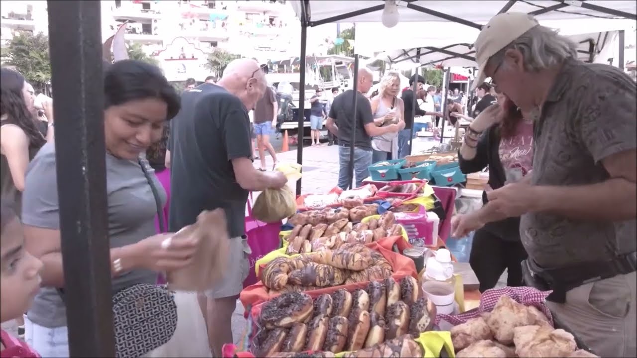
The Marina Puerto Vallarta Thursday Night Market not to miss. https://promovisionpv.com/the-marina-puerto-vallarta-vallarta-thursday-night-market-not-to-miss/
The Remance Sunday Market: On Sunday mornings, there is a small market (2 blocks long) in the Remance neighborhood. It is mostly a clothing and toy market with a couple of local produce vendors and food suppliers.
The Libramiento Thursday and Saturday Market: On Thursday and Saturday mornings, there is a small (2-3 blocks long) market right next to the Libramiento as you exit the second tunnel heading north. It is a large clothing and household goods market with a couple of local produce vendors and food suppliers. In Puerto Vallarta’s Romantic Zone, you’ll find a market named after the neighborhood in which it’s located. Inside, you’ll find a butcher shop, fish market, poultry shop, fruit stand, dairy, tortilla shop, grocery store, toy store, and other shops. Surrounding businesses include a flower shop, a seed and grain store, a locksmith, and stores selling chemicals and hygiene products.
We provide information and resources for visitors to Puerto Vallarta, areas of The Riviera Nayarit and other destinations in both states of Jalisco and Nayarit . You will find variety of content, including articles, blog posts, videos, photos, descriptions and interviews, all of which are designed to help visitors plan their trip, including attractions, restaurants, and events. Follow: https://promovisionpv.com/

Visit and Subscribe to our YouTube Channel for more Puerto Vallarta – Riviera Nayarit 220+ videos: Subscribe: https://www.youtube.com/@promovision/videos
Puerto Vallarta – Riviera Nayarit Archives 2024 Follow: https://promovisionpv.com/puerto-vallarta-nayarit-archives-2024/ Over 500 pages: Somethings you may not know about Puerto Vallarta, Riviera Nayarit and Mexico archives puerto vallarta, arts, bucerias, cirque du soleil, costa alegre, culture, destination wedding, events, events schedule, gastronomy, gay pv, gay vallarta, informations, insurance, Jalisco, lgbtq, medical care, mexican food, Nayarit, news, Nuevo Nayarit, Punta Mita, Rincon de Guayabitos, safety, San Blas, San Pancho, Sayulita, tourism, tours, travel, travel blog, travel guide, travel tips, wedding, YouTube videos, attractions, beaches, blog,
Follow: Web site: https://promovisionpv.com
Subscribe: YouTube: https://youtube.com/promovision/videos
Subscribe: Instagram: https://instagram.com/promovisionpv/
Follow: LinkedIn: https://www.linkedin.com/in/ray-dion-48861926/
Follow: Threads: https://www.threads.net/@promovisionpv
Follow: Facebook: https://www.facebook.com/profile.php?id=61576061534287
Follow: Blue Sky Social: https://bsky.app/profile/promovision.bsky.social
Marketing, Advertising Tourism, Restaurants, Real Estate, Events, Tours, Puerto Vallarta – Riviera Nayarit https://promovisionpv.com/marketing-advertising-tourism-restaurants-real-estate-events-tours-puerto-vallarta-riviera-nayarit-2/
The “7 Ps of Marketing” are: Product, Price, Promotion, Place, People, Packaging, and Process. This marketing mix is an expansion of the classic “4 P Marketing Mix” (Product, Price, Placement, and Promotion) that was established by Professor of Marketing at Harvard University, Prof.
Promote Your Tourism Business, Restaurant, or Tour Puerto Vallarta on PromovisionPV.com https://promovisionpv.com/promote-your-tourism-business-restaurant-or-tour-puerto-vallarta-on-promovisionpv-com/